

The largest earthquakes ever recorded by modern seismological instruments share a common origin: catastrophic rupture along subduction zones where oceanic plates plunge beneath lighter continental or island-arc crust. In these massive convergent plate boundaries, friction locks contiguous tectonic slabs together for centuries until the accumulated elastic strain overcomes frictional resistance, releasing immense quantities of mechanical energy. Every event in the global top ten achieved a moment magnitude of 8.6 or higher, generating long-period seismic waves capable of oscillating the entire planetary mass.
The exact destructive outcome of any giant earthquake depends on a combination of rupture dimensions, slip displacement, focal depth, local geology, and coastal bathymetry. When colossal ruptures occur under ocean basins, violent vertical displacement of the seafloor displaces entire water columns, spawning destructive transoceanic tsunamis that strike shorelines thousands of miles away. Evaluating these exceptional seismic events requires examining both calibrated moment magnitude determinations and empirical geological observations gathered across more than a century of instrumental monitoring.
Measuring Megathrust Events: Magnitude Versus Intensity
Seismology uses distinct scales to evaluate the fundamental energy of an earthquake versus the physical shaking experienced at specific surface locations. Moment magnitude (Mw) quantifies the total physical work completed by the fault during the rupture process, calculated from the shear modulus of the fractured rock, the total surface area of the rupture plane, and the average slip distance across the fault. In contrast, seismic intensity scales, such as the Modified Mercalli Intensity (MMI) scale, characterize localized ground motion and surface damage based on human perception, structural failure, and geotechnical disruptions.
Earlier magnitude scales, including the local magnitude scale developed by Charles Richter and standard surface-wave scales, systematically saturate when applied to massive subduction earthquakes. Because those older systems measured single wave amplitudes at set frequencies, they failed to register the extended duration and vast low-frequency energy generated by fault zones extending hundreds of miles. The moment magnitude scale remains free of this physical saturation threshold, providing an accurate metric for comparing 20th and 21st-century megathrust events.
Historical rankings depend upon modern re-evaluations of early twentieth-century analog seismograms alongside contemporary digital seismic telemetry managed by agencies like the U.S. Geological Survey. Small discrepancies occasionally exist among research institutions regarding the precise decimal magnitude of older events due to variations in assumed rock rigidity models, instrument calibration responses, and seismic moment inversion techniques. The ranking presented here reflects authoritative global seismic catalogs that focus strictly on instrumentally measured earthquakes documented since the widespread deployment of standardized seismographs at the beginning of the twentieth century.
Moment magnitude scale calculations rely directly on fault area, slip displacement, and crustal rigidity. A single integer increase on the moment magnitude scale represents a 31.6-fold surge in total radiated energy.
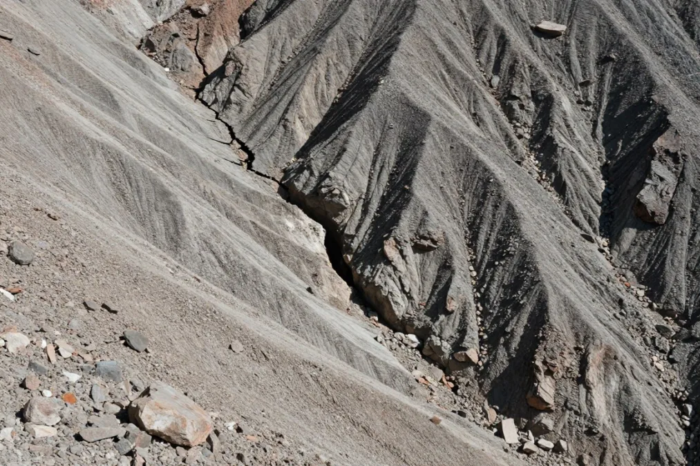
Surface ruptures along major fault zones expose the massive tectonic displacement responsible for planetary-scale seismic waves.
Summary of the Top 10 Earthquakes by Magnitude
Instrumental seismic records compiled over the last 125 years document only a handful of events reaching or exceeding magnitude 8.6. The following table provides a comprehensive overview of the ten largest instrumentally verified earthquakes, including rupture dates, epicentral locations, focal depths, and primary geological consequences.
| Rank | Magnitude (Mw) | Date | Location | Depth | Primary Impact |
| 1 | 9.5 | May 22, 1960 | Valdivia, Chile | 25 km | Basin-wide Pacific tsunami, massive landslides, and coastal subsidence across southern Chile. |
| 2 | 9.2 | March 28, 1964 | Prince William Sound, Alaska | 25 km | Widespread ground liquefaction, submarine landslides, and devastating regional tsunamis. |
| 3 | 9.1 | December 26, 2004 | Sumatra, Indonesia | 30 km | Catastrophic Boxing Day tsunami that struck coastal communities across fourteen nations. |
| 4 | 9.1 | March 11, 2011 | Tohoku, Japan | 29 km | Severe coastal flooding, major infrastructural destruction, and complex technological impacts. |
| 5 | 9.0 | November 4, 1952 | Kamchatka, Russia | 30 km | Severe settlement destruction from local tsunami runup and widespread Pacific waves. |
| 6 | 8.8 | February 27, 2010 | Maule, Chile | 23 km | Extensive structural building collapse, coastal wave surges, and widespread electrical grid blackout. |
| 7 | 8.8 | January 31, 1906 | Ecuador-Colombia | 25 km | Substantial coastal inundation, river mouth destruction, and high mortality in remote villages. |
| 8 | 8.7 | February 4, 1965 | Rat Islands, Alaska | 30 km | Ten-meter localized tsunami surges, runway cracking, and severe coastal bluff slumping. |
| 9 | 8.6 | August 15, 1950 | Assam-Tibet | 15 km | Mountain collapses, altered river courses, catastrophic debris dams, and widespread destruction. |
| 10 | 8.6 | April 11, 2012 | Northern Sumatra | 20 km | Record-breaking strike-slip intraplate rupture, moderate regional shaking, and minor localized waves. |
Each event in this record involved fault ruptures measured in hundreds of kilometers. Depths clustered between 15 and 30 kilometers reflect the shallow subduction interface where mechanical coupling between plates remains strongest.
1. 1960 Valdivia Earthquake (Magnitude 9.5)
The 1960 Valdivia earthquake, also known as the Great Chilean Earthquake, remains the most powerful seismic event ever recorded by instruments. On the afternoon of May 22, 1960, a massive rupture occurred along the subduction zone where the Nazca Plate plunges beneath the South American Plate. The rupture zone extended for approximately 1,000 kilometers along southern Chile, producing several minutes of violent ground shaking that permanently altered the regional geography.
Widespread coastal subsidence lowered large sections of the Chilean coastline by up to two meters, submerging coastal forests, pastures, and port facilities beneath the tides. In mountainous inland areas, severe ground motion triggered immense landslides that dammed rivers and formed unstable natural reservoirs, most notably along Lake Rinihue. Two days following the mainshock, the Cordon Caulle volcanic fissure erupted, spewing ash and steam along the Andean volcanic belt as regional crustal stresses redistributed.
The resulting tsunami traveled westward across the open waters of the Pacific Ocean at jetliner speeds, producing devastation far away from the South American coast. Runup heights reached over twenty meters along Chilean shorelines, devastated the Hawaiian port of Hilo with waves exceeding ten meters, and caused significant structural loss and fatalities along the eastern coasts of Japan and the Philippines. Total human casualties across Chile, Hawaii, Japan, and the wider Pacific basin reached into the thousands, with economic losses crippling southern Chilean infrastructure for decades.
The 1960 Valdivia earthquake released roughly twenty-five percent of all seismic energy recorded worldwide between 1900 and the early 2000s, representing an extraordinary planetary rupture.
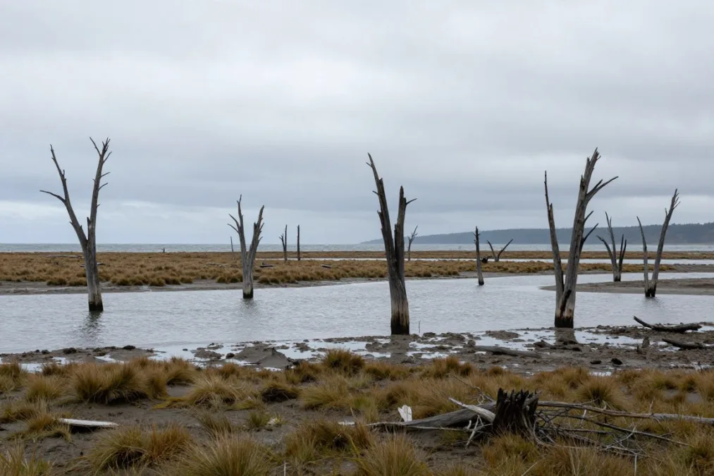
Coastal subsidence triggered by the Valdivia earthquake permanently submerged vast tracts of forested terrain beneath saltwater tides.
2. 1964 Great Alaska Earthquake (Magnitude 9.2)
Occurring on Good Friday, March 27, 1964, the Great Alaska earthquake ruptured the subduction interface along the Prince William Sound region where the Pacific Plate thrusts beneath the North American Plate. Striking at a focal depth of approximately 25 kilometers, the earthquake released energy for four and a half minutes. The protracted shaking destabilized glaciomarine sediments throughout south-central Alaska, leveling infrastructure across Anchorage, Valdez, and Seward.
The catastrophic physical impacts of this megathrust event stemmed from both direct seismic motion and severe geotechnical ground failure across coastal fjords:
- Severe soil liquefaction caused entire bluffs and suburban neighborhoods in Anchorage, notably Turnagain Heights, to collapse into Cook Inlet.
- Submarine landslides triggered localized displacement waves within narrow fjords, striking ports like Valdez and Whittier within minutes of the mainshock.
- Regional crustal warping elevated sections of the seafloor by more than nine meters near Montague Island, while inland areas subsided by over two meters.
- A destructive transoceanic tsunami traveled across the Pacific, damaging harbor infrastructure along the coasts of California, Oregon, Hawaii, and British Columbia.
More than one hundred people lost their lives, the vast majority drowned by local submarine landslide waves and the regional tectonic tsunami rather than structural building collapse. The exceptional documentation of surface warping, fault slip, and geotechnical failures in Alaska provided crucial field evidence that confirmed modern theories of plate tectonics and subduction zone mechanics.
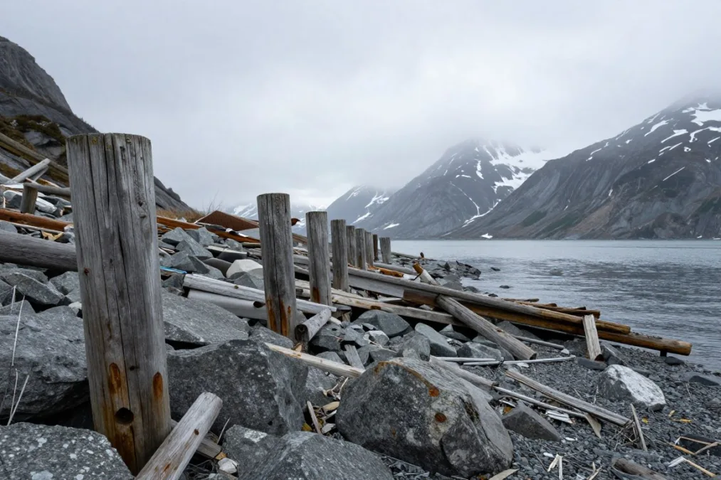
Fjord geometry concentrated the force of localized tsunami waves generated by massive submarine slides during the 1964 event.
3. 2004 Sumatra-Andaman Earthquake (Magnitude 9.1)
On December 26, 2004, an immense subduction earthquake struck off the northern coast of Sumatra, Indonesia, initiating along the Sunda Trench where the Indo-Australian Plate dives beneath the Burma microplate. The rupture initiated at a focal depth of roughly 30 kilometers and propagated northward over an unprecedented length of nearly 1,300 kilometers. The sustained slip event lasted nearly ten minutes, making it the longest faulting duration ever observed using modern seismic instrumentation.
The sudden vertical displacement of the seafloor lifted billions of tons of seawater, generating the catastrophic Boxing Day tsunami. Because the Indian Ocean lacked an integrated, operational tsunami early warning system in 2004, coastal populations received virtually no formal alert before immense surges made landfall. Unobstructed ocean waves struck surrounding coastlines with catastrophic energy, obliterating entire cities, provincial capitals, and small fishing hamlets across the basin.
- Northern Sumatra experienced runup heights exceeding thirty meters, leveling urban centers in Banda Aceh within minutes.
- Low-lying coastal areas throughout Sri Lanka, eastern India, and southern Thailand suffered immense structural destruction and unprecedented loss of life.
- Measurable wave surges and localized flooding reached as far away as Somalia, Kenya, Tanzania, and South Africa along the western rim of the ocean basin.
- Total confirmed casualties exceeded 227,000 individuals across fourteen nations, marking it as the deadliest tsunami disaster in recorded human history.
The catastrophe served as a monumental turning point for international geophysics and civil protection agencies. Following the event, global scientific coalitions deployed an extensive network of deep-ocean tsunameters and coastal tide gauges across the Indian Ocean to detect seismic disturbances and alert vulnerable populations in real time.

The open waters of the Indian Ocean offered no resistance to the destructive tsunami waves radiating outward from northern Sumatra.
4. 2011 Tohoku Earthquake (Magnitude 9.1)
On March 11, 2011, the northeast coast of Honshu, Japan, was struck by the Great East Japan Earthquake, centered approximately 72 kilometers east of the Oshika Peninsula at a depth of 29 kilometers. Rupturing the megathrust boundary where the Pacific Plate subducts beneath the continental Okhotsk Plate, this magnitude 9.1 event generated staggering slip displacements exceeding fifty meters near the shallow trench axis. Seismological arrays and offshore ocean-bottom sensors recorded horizontal seafloor movements of up to twenty-four meters.
Japan boasts the most advanced seismic building codes, early warning systems, and tsunami seawalls in the world, which prevented extensive structural collapses from ground shaking alone. However, the sheer physical scale of the resulting tsunami overwhelmed coastal defenses throughout the Tohoku region. Waves reaching runup heights of up to forty meters swept over reinforced concrete seawalls, inundating over five hundred square kilometers of coastal plains, leveling towns, and carrying ships, vehicles, and housing debris miles inland.
The tsunami inundation resulted in catastrophic secondary consequences at the Fukushima Daiichi Nuclear Power Station. Flooding submerged backup diesel generators, cutting electrical power to critical reactor cooling systems and initiating core meltdowns and radiation releases that forced the prolonged evacuation of hundreds of thousands of residents. Over 18,000 people were killed or confirmed missing, nearly all lost to the inundating sea surges, making it the costliest natural disaster in modern economic history.
Engineered seawalls and hardened coastal defenses proved inadequate against tsunami wave runup heights that vastly exceeded historical municipal design assumptions along the Tohoku coastline.
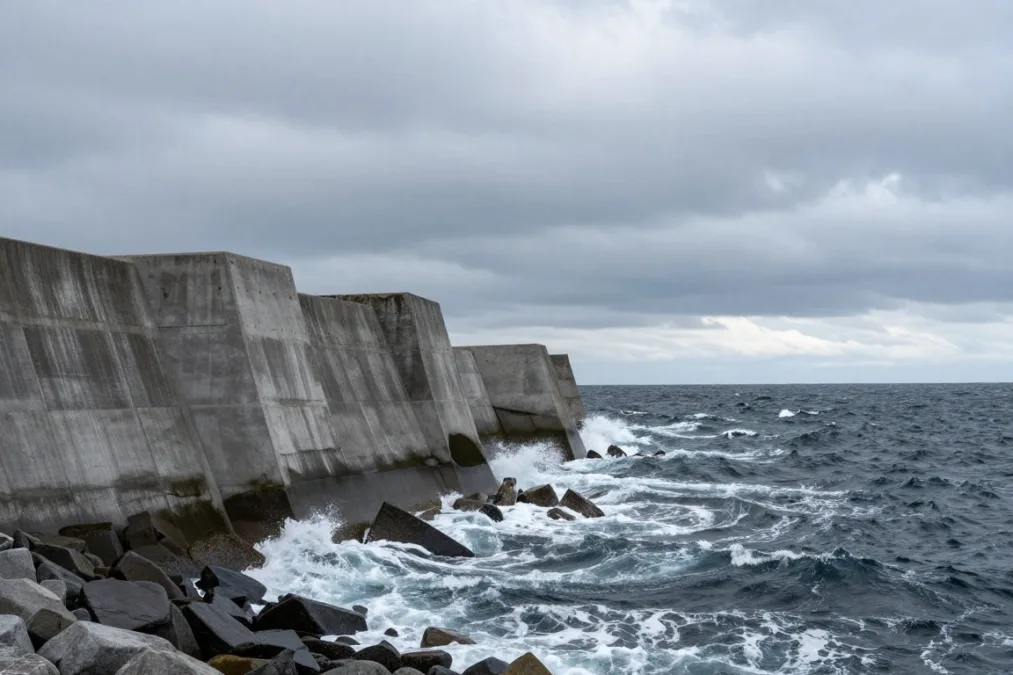
Coastal protective structures throughout northeastern Japan were overwhelmed when tsunami surge heights far exceeded historical projections.
5. 1952 Severo-Kurilsk, Kamchatka Earthquake (Magnitude 9.0)
On November 4, 1952, a magnitude 9.0 megathrust earthquake ruptured the subduction zone along the Kamchatka Peninsula in the Russian Far East. Occurring at a shallow focal depth of roughly 30 kilometers along the Kuril-Kamchatka Trench, the earthquake was triggered by the high-velocity convergence of the Pacific Plate beneath the Okhotsk Plate. The massive rupture generated intense shaking that lasted for several minutes across sparsely populated coastal settlements and military outposts.
The primary devastation was delivered by three successive tsunami waves that slammed into the Kuril Islands and the Kamchatka coastline. The fishing town of Severo-Kurilsk on Paramushir Island suffered catastrophic damage when residents, having fled the initial shaking to higher ground, returned to town after the first wave receded, only to be engulfed by an eighteen-meter second wave. Between two thousand and four thousand residents died during the inundation, and the town was subsequently rebuilt on higher ground away from the shoreline.
Local Destruction
Severo-Kurilsk and adjacent fishing settlements were almost completely leveled by repeated wave inundations within an hour of the mainshock.
Transoceanic Reach
The tsunami crossed the Pacific Ocean, tearing boats from their moorings and causing widespread harbor damage throughout the Hawaiian Islands.
Seismic Legacy
The disaster prompted the Soviet Union to establish its national tsunami warning system, mirroring networks developed by Pacific neighbors.
Wave heights along the Hawaiian island of Oahu exceeded four meters, causing severe infrastructural losses to roads, piers, and shoreline residences, though effective warnings prevented fatalities. The 1952 Kamchatka event confirmed that the Kuril-Kamchatka subduction boundary is capable of producing top-tier planetary earthquakes alongside its neighboring Aleutian and Japanese trenches.
6 & 7. 2010 Maule and 1906 Ecuador-Colombia Earthquakes (Magnitude 8.8)
The sixth and seventh positions in the global magnitude hierarchy belong to two immense South American subduction earthquakes, each registering a moment magnitude of 8.8 along the active convergence boundary where the oceanic Nazca Plate slides under the continental South American Plate. Despite sharing identical calculated magnitudes, these two events occurred over a century apart, demonstrating distinct regional consequences and differences in historical seismic documentation.
- Ruptured approximately 500 kilometers of the subduction zone in central Chile on February 27, 2010, at a depth of 23 kilometers.
- Generated strong shaking that damaged modern multi-story buildings, bridges, and industrial ports across major metropolitan centers including Concepcion and Santiago.
- Triggered localized tsunami surges that destroyed coastal villages across south-central Chile within minutes of the mainshock.
- Modern digital networks recorded the rupture in real time, capturing horizontal ground displacement exceeding three meters.
2010 Maule Earthquake
- Ruptured roughly 500 to 600 kilometers of the plate boundary offshore Esmeraldas, Ecuador, on January 31, 1906, at a depth of 25 kilometers.
- Generated an extensive transoceanic tsunami that flooded low-lying coastal estuaries and destroyed isolated fishing villages.
- Caused between one thousand and fifteen hundred fatalities, mostly due to the rapid arrival of giant waves along coastal river mouths.
- Documented by early analog seismographs in Europe and the Americas, requiring modern waveform inversion to determine its true magnitude.
1906 Ecuador-Colombia Earthquake
The 2010 Maule event was one of the most thoroughly instrumented megathrust ruptures in seismological history, providing valuable acceleration records that helped engineers upgrade building designs internationally. The 1906 event remains a sobering reminder of the long recurrence intervals characteristic of northern South American subduction segments, where strain accumulates quietly over multiple centuries before releasing suddenly.
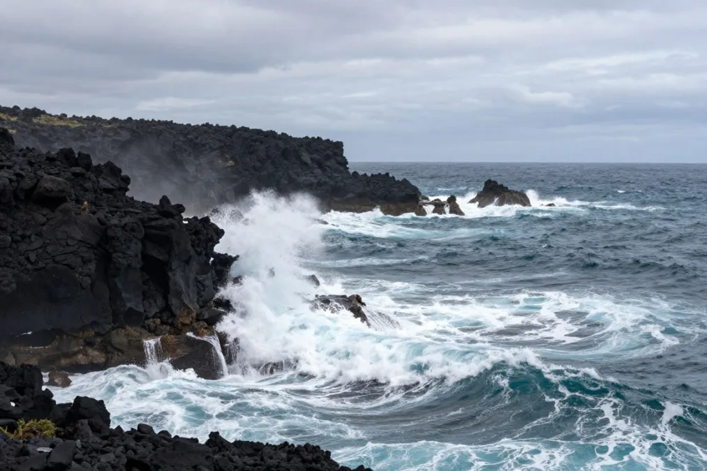
The western margin of South America remains locked along the Peru-Chile trench, accumulating tectonic strain over centuries.
8, 9 & 10. Rat Islands, Assam-Tibet, and Northern Sumatra (Magnitudes 8.7 to 8.6)
The final three entries among the ten largest earthquakes illustrate the diverse geological environments capable of generating seismic ruptures exceeding magnitude 8.5. While subduction boundaries dominate global seismic records, continental collision zones and complex intraplate strike-slip faults can also rupture with astonishing force.
1965 Rat Islands (Mw 8.7)
Rupturing a 600-kilometer stretch of the Aleutian subduction trench at a depth of 30 kilometers, this subduction event produced a ten-meter tsunami that swept across Shemya Island and cracked military airstrips across the remote western Aleutians.
1950 Assam-Tibet (Mw 8.6)
This colossal continental collision rupture occurred along the convergent boundary between the Indian and Eurasian plates at a shallow depth of 15 kilometers, shaking loose catastrophic mountain collapses and altering river flows across northern India and Tibet.
2012 Northern Sumatra (Mw 8.6)
Occurring within the oceanic crust of the Wharton Basin at a depth of 20 kilometers, this extraordinary strike-slip earthquake shattered a complex grid of orthogonal faults, standing as the largest strike-slip event ever recorded.
The 1950 Assam-Tibet event represents the largest purely continental earthquake recorded by modern instruments. Enormous rockfalls dammed the Subansiri and Dihang rivers; when these natural debris dams subsequently collapsed days later, catastrophic floods inundated the plains of Assam, drowning villages and claiming thousands of lives. In contrast, the 2012 Northern Sumatra event occurred entirely through horizontal slip along vertical fault planes, generating only minor localized waves despite its exceptional 8.6 moment magnitude.
Historical Events and Instrumental Seismology Limits
The global ranking of earthquakes by magnitude relies strictly upon the instrumental era, which began roughly around 1900 with the widespread adoption of undamped and mechanical seismographs. Prior to that technological threshold, seismologists cannot calculate precise moment magnitudes because continuous instrumental waveform records do not exist. Historical assessments of pre-1900 disasters must rely instead on written accounts, architectural damage reports, and geological fieldwork.
Advantages of Instrumental Data
- Direct recording of ground acceleration, period, and displacement amplitudes.
- Objective calculation of seismic moment using digital waveform inversion.
- Precise mathematical determination of focal depth and rupture velocity.
Limitations of Pre-Instrumental Records
- Magnitudes must be indirectly inferred from structural damage and written chronicles.
- Focal depth, directivity, and slip distribution remain highly uncertain.
- Historical accounts often conflate localized soil liquefaction with extreme magnitude.
Geological investigations of paleoseismic records indicate that catastrophic earthquakes occurred repeatedly throughout human history and prehistory. The 1700 Cascadia earthquake along the Pacific Northwest coast of North America is estimated to have achieved a moment magnitude between 8.7 and 9.2 based on coastal subsidence sediments and tsunami records documented in Japan. Similarly, the 1755 Lisbon earthquake and the 869 Sanriku earthquake produced immense regional destruction, yet they cannot be placed into an authoritative decimal magnitude ranking due to the lack of instrumental seismic recordings.
Frequently Asked Questions About the Largest Recorded Earthquakes
Can an earthquake reach a magnitude of 10.0?
Theoretical physics indicates that an earthquake of magnitude 10.0 is exceptionally unlikely on Earth because no single continuous fault line is long enough to accumulate and release that much strain. Generating a magnitude 10.0 event would require rupturing a fault zone extending around a substantial fraction of the entire planet.
Why do most giant earthquakes occur around the Pacific Ocean?
The Circum-Pacific Belt, commonly known as the Ring of Fire, contains the vast majority of the world’s active subduction zones where cold, dense oceanic plates slide beneath continental margins. These long, continuous megathrust interfaces provide the enormous friction surfaces required to produce seismic ruptures above magnitude 8.5.
How does focal depth influence an earthquake’s surface damage?
Shallow focal depths between 10 and 35 kilometers concentrate seismic energy directly into the Earth’s surface crust, producing intense ground acceleration and severe structural shaking. Deeper earthquakes lose significant high-frequency energy as seismic waves attenuate while traveling upward through hundreds of kilometers of the mantle.
Why do published magnitude estimates sometimes differ between scientific agencies?
Discrepancies arise because different research organizations apply varied crustal velocity models, wave frequencies, and mathematical inversion techniques when analyzing complex broadband seismograms. Minor variations of 0.1 or 0.2 magnitude units are common as researchers refine their fault slip models over years of post-event analysis.
Does a higher magnitude always produce a higher death toll?
Higher magnitude does not automatically translate into greater fatalities because population density, local building quality, and tsunami generation dictate human survival. The 1964 Alaska earthquake of magnitude 9.2 caused fewer than 150 deaths in a sparsely populated region, while the 2010 Haiti earthquake of magnitude 7.0 resulted in over 100,000 casualties due to vulnerable masonry construction.
The Legacy of Global Megathrust Earthquakes
The 1960 Valdivia earthquake stands as the undisputed pinnacle of instrumentally recorded seismic energy, releasing forces that reshaped coastlines and rattled the planet for days. Modern seismic networks, deep-ocean monitoring stations, and strict engineering standards have substantially reduced the risk of structural collapse and unheralded tsunami inundation. Continuous geophysical monitoring of subduction boundaries remains essential for anticipating future megathrust ruptures along the locked margins of the world.

Priyanka Pandey
Senior Research Editor · Top10Sense
Priyanka specializes in tech, consumer products, and digital trends. She combines hands-on testing, vendor interviews, and database research to create trustworthy “Top 10” rankings. Her work has been referenced by industry blogs and brand report pages.